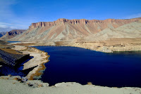
Badakhshan is Afghanistan's northern (and eastern) most province. It's the part with the thin panhandle stretching out to China. A few days ago I got back from a five day field mission to evaluate a four schools and a medical clinic. The area is truly amazing, a land of deep canyons, high passes and rushing rivers.
I have mixed feelings about this country, especially in light of recent events, but this area was amazing and gave me a renewed motivation here.
The province is the most remote and least populated area of the country, it was also never under the control of the Taliban as it was the under the
Northern Alliance's (
Massoud's government) hands. We chose this area to start our evaluations because of it's high seismicity, heavy snow fall and safe location. (Nuristan was our first choice, but due to the decaying security situation, where the military can't even get to most of the area, we put it on the back burner. They say Nuristan is at least, if not more dangerous than Kandahar or Helmand provinces in the south.)
 Landing on the Soviet built steel runway
 The USAID plane and our security team
We flew from Kabul to the provincial center, a town of 50,000 people, Faizabad. From there we did day trips to the school and medical clinic sites.
 Richie and I overlooking the new part of Faizabad.

The first day took us up a steep canyon, crossing a crazy bridge on the way. The village at the end, Chakada sat on the steep hillside in a bone dry canyon.
 The Kokcha River
 crazy bridge
 heading up the canyon
 Richie thinking he's an engineer (he's the security team lead)
 one of the schools
 village of Chakada
The Bakharak Valley (which was done on the 3rd day, the route that stretches to the far right) is an Garden of Eden. Fresh mountain streams flowed everywhere creating a green valley growing apples and grapes.
 again, passing the Kokcha River
 Nomadic people moving to the lowlands for winter. I really wish this photo was clear, but the car was bouncing all around and I was holding on with one hand and the camera with the other.
 the deep canyon with the Kokcha River
 one of the schools, everybody is looking up into the sky as a fighter jet roars overhead.
 This girl was watching me, so I took her picture.
 Bakharak Valley, Me, Akmal (Afghan engineer) and Richie.

We only saw the one medical clinic on this day, it took 4 hours to drive to (one way). But it was an awesome ride, climbing over Shiwa Pass and then off-roading down the Shiwa river valley.
 Climbing Shiwa Pass
 Shiwa Pass (9600ft)
 Stretch break at Shiwa Pass
 Passing a Nomadic camel train heading for the lowlands for winter.
 Fording the Shiwa River
 Follow the leader
 Four hours later, Shiwa Medical Clinic


.JPG)
.JPG)
.jpg)


